Monday, February 21, 2011

Drew and GrandMary's Day Together

On February 12th Drew had a play date with Grand Mary as was promised back in January.
He arrived Friday evening for a sleep over, with cloths, snacks, and games. He was prepared!
Next morning Grandpa went to a church meeting while the others had fun, lunch out, and lots of exercise.
First stop was a place called Fiesta Fun for 18 holes of Golf. 

Before he finished the second round his stroke was smooth. He had a hole-in-one before getting tired or bored.

The place was busy that day and so there was some hanging around waiting for the next event.

This smile will get him a long way in life.

Bumper Tubs on a warm spring day in February anyone.

This is not what you think! Up the street from Grandma's house is a park with rocks from the past.

Drew was able to get up close and personal in this park.

Look Mom! Grandma said I could! Fall? Not me.

Ouch! My elbow is scrapped.

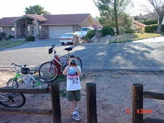
After a little water break from the bikes it is back to the rocks.

As you can see jumping is part of being a boy. He must have repeated this action 20 times.

Just hanging out on top was also repeated. He had ridden about 45 minutes before the rock park.

While the weather is getting warm it is still safe to walk around without worry of snakes or spiders.

They ended up home about 5 and catch was still on the list to be done.

After this throw Grand Mary was told she throws like a girl. Dah!

Grand Mary went inside to cook supper and Grandpa spent the next hour working on catching with two hands. Drew's mom reported he hit the bed early and fell asleep while talking about the day.


Saturday, January 29, 2011

Johnson Canyon

This is listed as "2 miles round trip. Easy. Level with some rocky slopes and steps. Leads to a sheltered canyon of willow and cottonwood, winding through lava flows and red rock to an arch spanning 200 feet.
Closed annually from March 15 - October 31."

After reading this information we headed out this morning at 10:30 AM for a hike into parts of Snow Canyon that is not within the State Park or at least before the Fee Station. As we parked in the small lot just outside the entrance to the Park it was already full of cars. We met hikers in family groups, teenages, runners, folks more mature than us, mothers chasing boys, fathers carrying babies. All as one lady said; "In Gods church."

We crossed the road and started along the path as shown in the map. We read the warning about the loose rocks and staying on the path. The level part was only partly true. The few pictures below can not do justice to the beauty within this canyon.


Looking across the road at the trail head toward the red rocks we are headed for about a mile away.


This trail is closed part of the year. We are looking for reason why


Beginning of trail gives false impression!

As you get about a block up the trail you cross over into the lava beds.

Trail is pick route and choose you steps carefully.

Then you round the bend and look down into a valley wash.

Another view from about 25 yards back down trail.

This rock spoke to me, first as ET then coming down I saw a Manatee head.
As you turn away from the wash you see where the rock came from.

The green growth is 200 feet up the cliff.

This talks about the 2005 flood that changed this canyon.

Mary walking up hill to the end of the trail.
Just enough seepage to sustain growth in the bottoms.

This is a puddle left from the December 2010 rains at trails end. 

Looking away from the puddle to sunny side of canyon.

About 50 yards before end of trail, off to side is small spring.

The old and older as we started back out of canyon.

Looking back as we walked out of Johnson Canyon after two hours.


We did find the arch on the way back out because the sun had changed angles and we were looking around more. It is hard here to see but the arch is in the foreground and rocks behind are a good 300 yards away. Sun was just not at correct angle to put a shaft of light between the two. Maybe next trip will be later in the day.

Saturday, January 22, 2011

Temple Quarry Trail -St. George, Utah

Today we finished cleaning up another section of the yard, took two truck loads to the land fill, had a light lunch, then decided to take a hike.

During the week Mary had picked up a printing from the St. George - Leisure Service Department.
In this we were able to see the mileage, type of trail surface, and access. We decided to explore the
Temple Quarry Trail.
This is at the Trailhead and tells who and why they took until 2007 to set up the trail.


This shows Mary with a quick step after being on the trail for about 90 minutes. We only traveled 2.1 miles, but watching each step and only looking round after stopping, with solid footing, did we realize just what views were around us.
I am showing you the steps down to the beginning only so you understand we came up the very narrow trail below onto the steps going up.


You can make out the trail on the side of the ridge, if you look carefully.

That is green sage brush and black rock on the hill side.


Once up the stairs the trail widened out and was more or less level.

You can see some of the sites from this angle.


The reason for the trail as outlined on a sign as you start your hike.


To remind us that even in the black rocks, people felt it was important to keep cattle and people out of places they should not be.
My question is why did they have to share the same sandy space in the rocks?


Looking back towards St. George and Pine Mountain, with red rock cliffs showing in the fore ground. Snow is going to help summer growth if it comes down slowly.


This view is toward Ivins, Snow Canyon is in the right side of the photo.


If we had a close up lens you might have seen the markings on the hillside telling you it was Green Valley across the way.


Far across the valley is the ridge that over looks our little home in Bloomington.


As we hit the trail end we were standing where the rocks were quarried. Some still have the bit mark on them.


Others just showed the natural wear and this one had a bubble when it came to the surface.


It really is a trail end!
It is too bad that someone has not replaced the sign.


A new one is mounted into a rock, but this tells the real story.

Great day for a walk, didn't get lost, didn't fall,
didn't get too winded, and did enjoy the sunshine.

Next time one of us will need to put on sun screen before heading out.